Day 52: Mangatepopo Hut to Waihohonu Hut (19.3 km)
Friday, January 20
I stirred around 3 or 4 am and heard raindrops lightly battering the roof of the hut. The night before I had contemplated waking up for sunrise, but I groggily came to the realization that rain meant the clouds wouldn't leave the sky before the 5:30 am sunrise. I rolled over and decided I'd go back to sleep until the rain stopped. There didn't seem to be a hurry.
Around 6:30 or 7 I couldn't sleep any longer. I ate some OSM bars for breakfast, listening to the off and on drizzling. When I left the hut to go to the bathroom I saw the surrounding mountains veiled in clouds. At one point the clouds broke in a small area for a few minutes and I could see a light dusting of snow frosting the mountains. That would be fun to walk through.
Last night I realized I got a tiny bit of cell phone service when I sat in my bed, so I checked the weather. The hut warden wasn't at the hut before I went to bed and still hadn't arrived, so it was the only way to get the updated weather forecast. Everyone that was awake in the hut wanted to look at it and take their best guess as to what the day had in store for us.
I decided to leave at 9 am or when the drizzling stopped. Whichever came first. The hut warden finally arrived before 9 and said there would be snow on the crossing but it wouldn't make it any more difficult to walk, so I left.
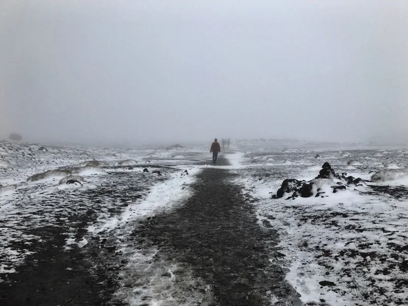
A loose line of people filled the trail, and there was a short line for the drop toilets. Luckily the hut has its own so I didn't need them. I wandered over to look at the Soda Springs, 200 meters from the main trail. When Kristen and I walked by on Tuesday it was clear enough to see them from the main path m. Now there was no chance of seeing 200 meters ahead of you in the morning mist.
As the trail began its uphill climb, damp snow began sticking to the trail. I had decided to rock the socks in my Chacos until that got too cold, so I tried to avoid all the puddles. Hiking uphill is always more difficult for me when I can't see how high I need to climb. Usually it's because of trees in the forest blocking my view, but today it was because of mist. This was the same trail I had hiked Tuesday, so I tried to remember, but it felt much more difficult and I kept stopping to let day hikers with their little tiny backpacks pass me.
The difference between Tuesday and today was unbelievable. As I reached the sign for where trampers can turn off to climb Mount Doom, I couldn't even see the base of the mountain, much less the top. Yesterday I had planned to hike to the top of Mount Tongariro as I walked past but I assumed it would be as impossible to see as this mountain. As I walked across the flat area after Mount Doom, I couldn't see past a few people in front of me.
Then the steep climb to Red Crater, the high point of the Tongariro Crossing, began. At one point there is a chain to help people get up a steep rocky section. A line of people had formed, waiting on the slush-covered and slippery ground. The line moved extremely slowly. While I was hiking I had been a little cool, but now I was starting to get cold just standing there. I could have pulled a layer or two out of my pack but it didn't seem worth the hassle. Once I made it up the chain I'd be warm and walking again. And I had just seen all my friends in Fairbanks, Alaska posting about the negative 50 degree temperatures. This was nothing compared to that!
As I waited in line slowly slipping my way through the slush to the chain, people tried climbing up the rocks to avoid the chain and the line. This made little rocks rain down on the people waiting. After a few minutes I made it to the chain and pulled myself up. I was getting cold and grumpy and wasn't looking forward to the steep climb down from Red Crater. It had been tricky on Tuesday and I imagined the snow would only make it worse today.
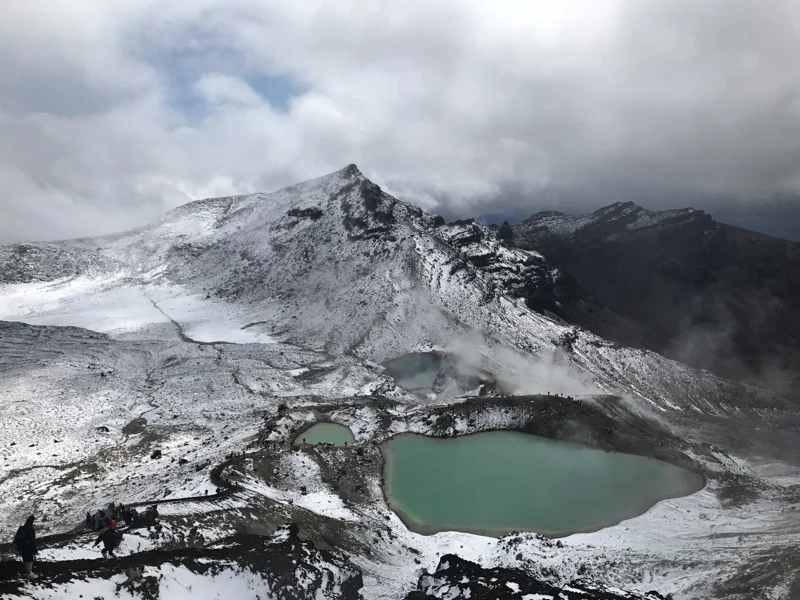
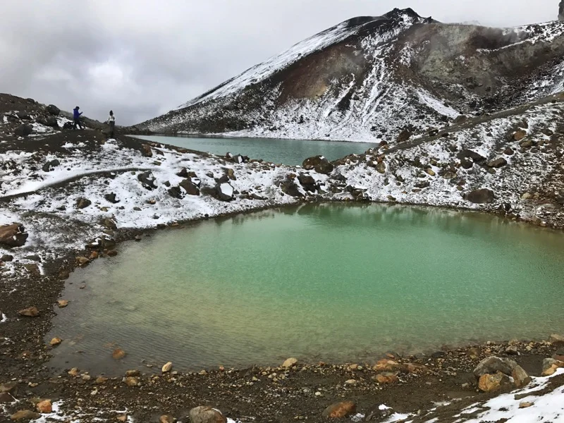
Before the last push up to Red Crater, I stopped and put on my trail runners. Hiking in socks and sandals, though stylish, didn't seem like the best idea any longer. It ended up being a good decision. I quickly made it up to Red Crater. Although I couldn't see as much of the crater as Tuesday, the view of the Emerald Lakes was gorgeous. The green-blue lakes rimmed with snow was a completely different sight from a few days ago. It made all the slush walking worth it and put me in a much better mood. Now I just had to walk down to those lakes and on relatively flat ground for an hour and a half to make it to the hut. I'd be there by 1!
After taking some photos on my phone I began walking down the scree. It was so much easier than Tuesday because it was damp. Who would have thought?
It took no time at all to walk by the lakes and I turned off the Tongariro Crossing to go to Oturere Hut. About a minute after turning I ran into Alex and Jaysen from yesterday and another TA tramper named Max. They had gone a few minutes off the the crossing to take photos. We quickly said hello to each other went our separate ways. It was cold so none of us wanted to stop long and there's a good chance we'll all see each other on the river.
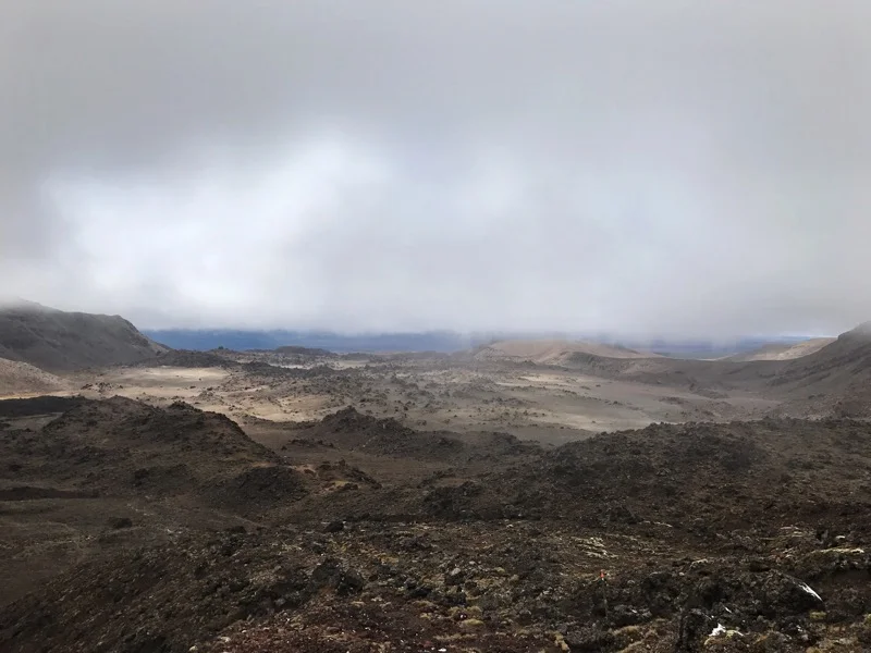
As I continued the snow quickly began to fade away and it warmed up a bit. The sky began to turn blue, Mount Ruapehu began to peek out of the clouds, and the landscape began to feel otherworldly. They probably could have used this area of the park to film The Martian.
In no time at all I reached the hut and a Scottish and Israeli couple that had been at the Mangatepopo Hut last night were eating lunch. I talked with the four of them and ate some snacks. They all were planning to go on to the next hut.
I claimed my bunk, unpacked my sleeping bag and boiled some water to mix with chocolate milk mix and instant coffee. Some other hikers showed up and the hut warden came out to talk with us. He was really nice and told us that there was a severe weather warning coming in tomorrow evening through most of Sunday.
According to the warden, Waihohonu Hut was only a 2-3 hour walk away, had a lot of empty bunks, and was the nicest hut in the park. If any of us wanted we could walk there today so we wouldn't have to walk those extra hours and kilometers to get out of the park tomorrow. It sounded like a good idea to me! I packed up my stuff and headed out. By now it was about 3 or 3:30.
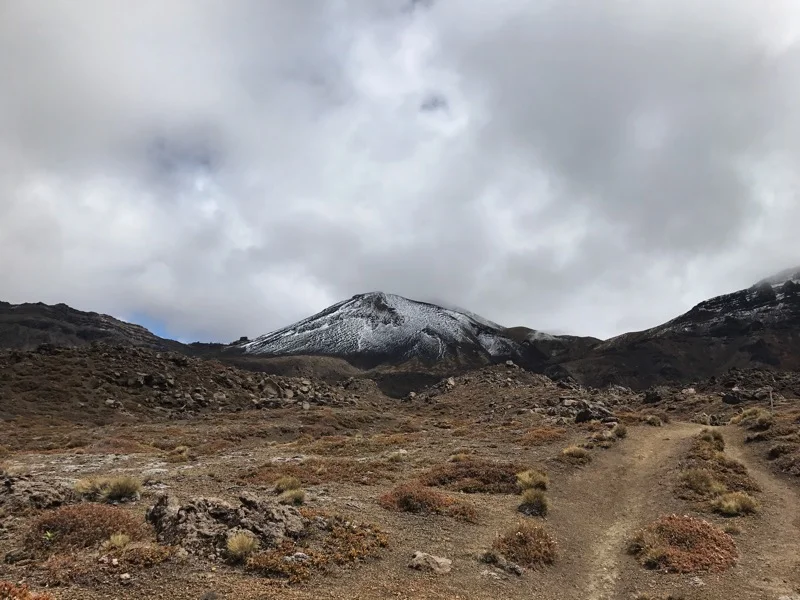
The trail to Waihohonu was wonderful. It was similar to the trail to Oturere Hut, but it had a few tiny forest sections and a nice bridge or two. Mount Ruapehu kept trying to break out of the clouds and Mount Doom's head kept hiding. It was beautiful to hike with (most of) them in view.
In two hours I had made it to Waihohonu campground and said hello to the Scottish couple as they set up their tent. They said the hut was amazing. A few minutes later I arrived and they were right. It was the most beautiful hut I'd seen in New Zealand. It had 3 bunk rooms, huge porches, and a big open area with two kitchen counters. Huge windows in the common area framed Mount Doom and Mount Ruapehu.
It was about 5:30 and the hut meeting wasn't until 7:30 so I decided to go to some cold springs that were a little hike away. The water was a clear blue and freezing. I waded up to my ankles and dunked my hair in. It was refreshing and my legs tingled as I pulled them out and dried off. I walked back to the hut and made my gourmet ramen dinner with dehydrated veggies and a salmon packet. Since I had skipped a hut today, I decided I got to eat two dinners. It was great!
As I was eating Robin, the German TA hiker I tramped with to the forest with the muddy Bell Track, walked up to the hut. I was so surprised to see him! He told me what he'd been up to since the forest, and was tramping the Northern Circuit in the opposite direction I was.
At 7:30 we had our hut meeting with a really cool hut warden. He told us the weather forecast and a Maori story about how the mountains and rivers ended up where they are today.
I can't remember the names of all the mountains, but two guy mountains were fighting for a lady mountain. One cut the head (the top is the most sacred part of a mountain in Maori culture) off the other. It is an island in a nearby lake now. But the one who got part of his head cut off survived and ended up defeating the other mountain. The defeated mountain ripped away, creating a waterfall in the national park and then created a trail, the Whanganui River, to where it now stands. In Maori culture, mountains can only travel at night, so that's how far the mountain was able to get that night. Hopefully I didn't mess any of that story up. Maybe if I have some time at a library I can look up more of the details and fill in the gaps.
After his talk, I asked him what he thought about continuing the Round the Mountain Track. It would probably involve me staying in a hut one day to wait out weather. I could manage that because I had skipped a hut today, but he wasn't sure how the river crossings would be. When I'm hiking by myself I've become really weary of New Zealand river crossings. On two occasions I've had to swim or practically swim to make it across water. And those were calm. There was no way to predict how the weather would be in 3 days and I didn't want to get stuck between two high rivers and risk missing the river trip on the 26th.
Two ladies at the hut who were sitting with Jared, Bronwyn and Gail, had turned around from the trail I was planning to walk because of weather and gale force winds. Although I really wanted to do that hike, I had gotten great views of Mount Ruapehu today and getting to National Park tomorrow and Taumarunui early seemed like the safest decision.
I talked with the three of them for a bit and went to bed. Tomorrow I want to start early to miss the rain.
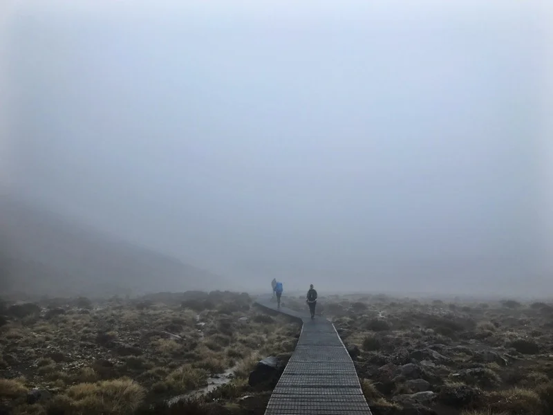
Morning mist on the boardwalk to start the day
Soda Springs veiled in mist
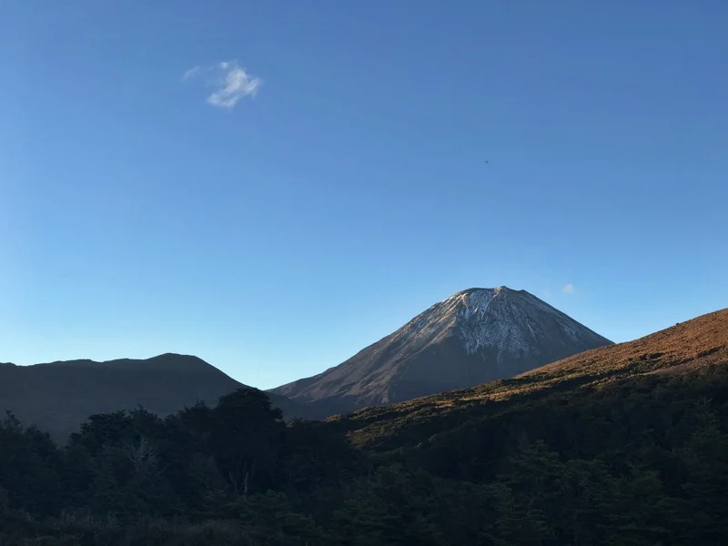
Mount Doom was here on Tuesday
The flat section before the uphill to Red Crater
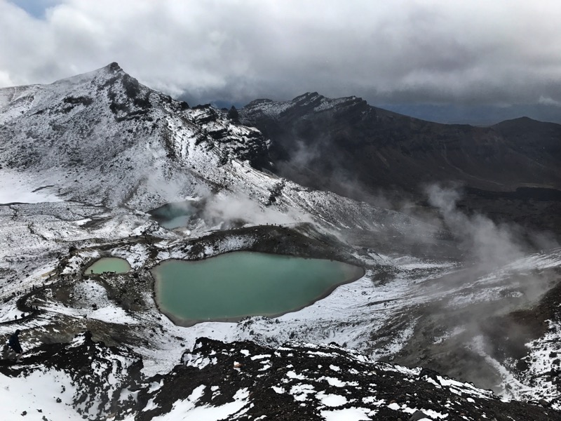
Emerald Lakes rimmed with snow
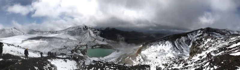
More Emerald Lakes
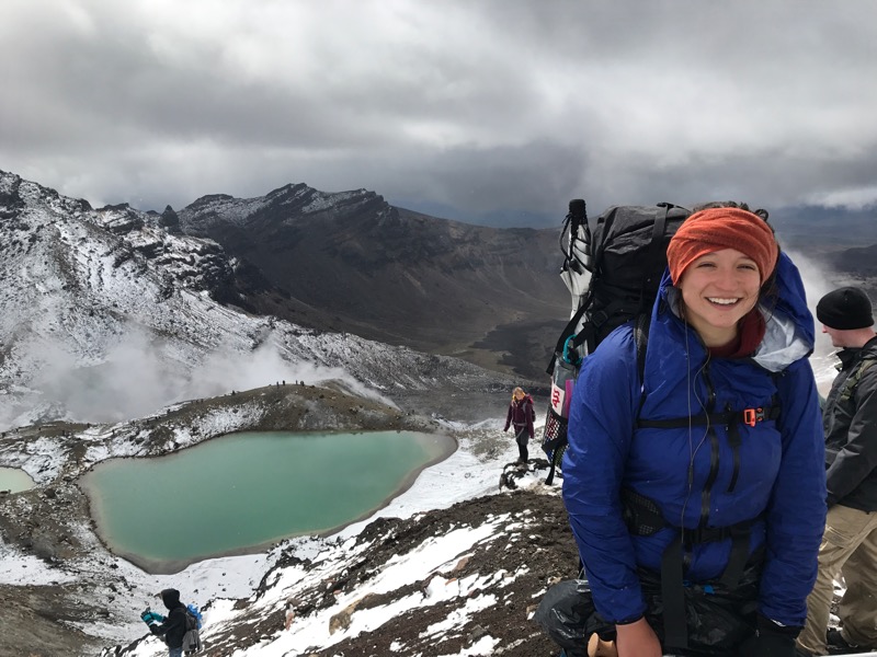
A nice guy took my photo
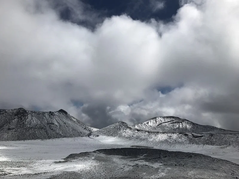
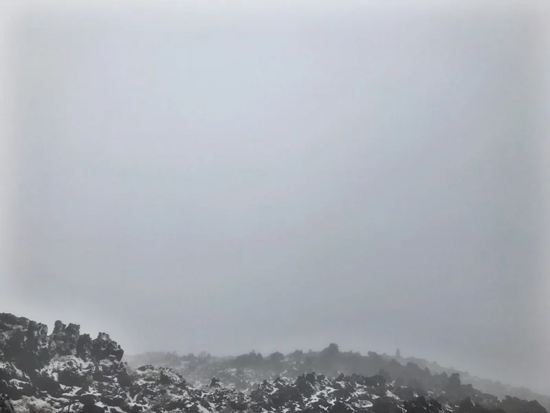
Snow on the mountains.
One last image of emerald Lakes
The trail to Oturere Hut
More alien-looking landscape on the way to the hut
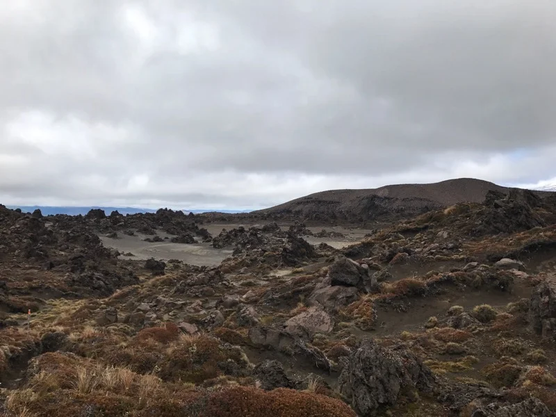
One more alien landscape
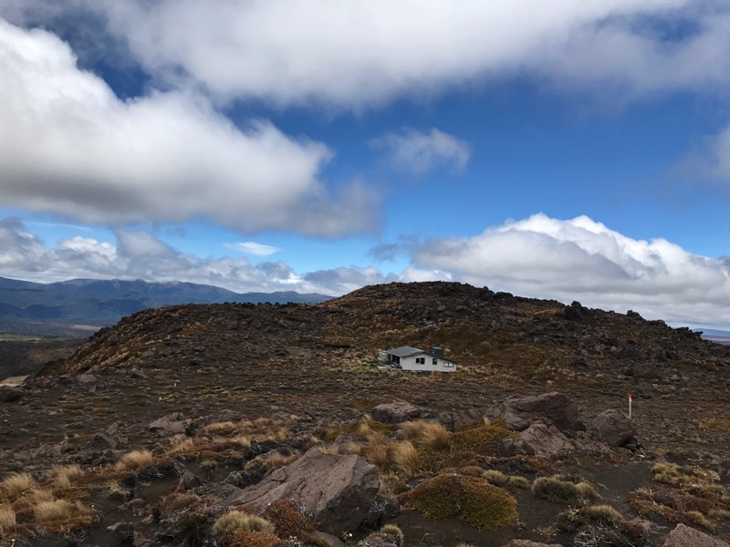
Oturere Hut
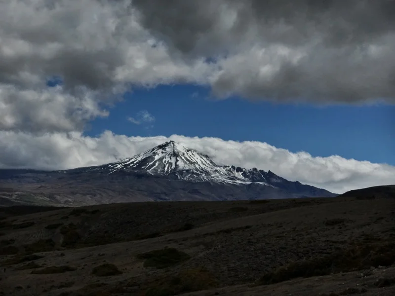
Mount Ruapehu
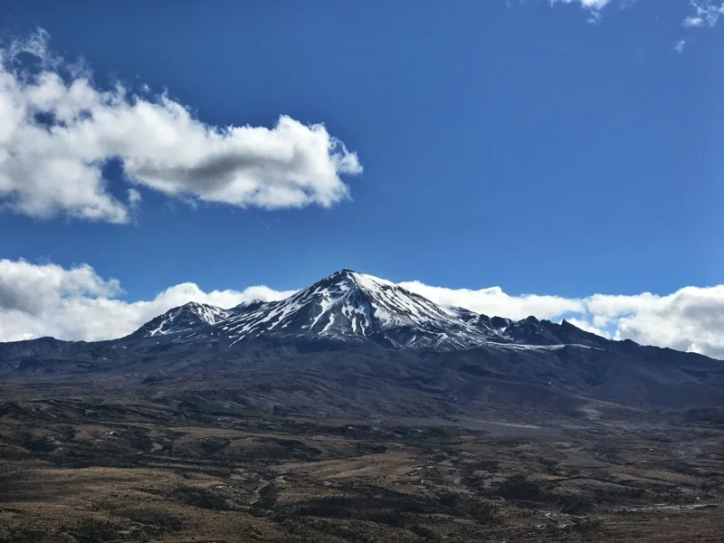
Mount Ruapehu
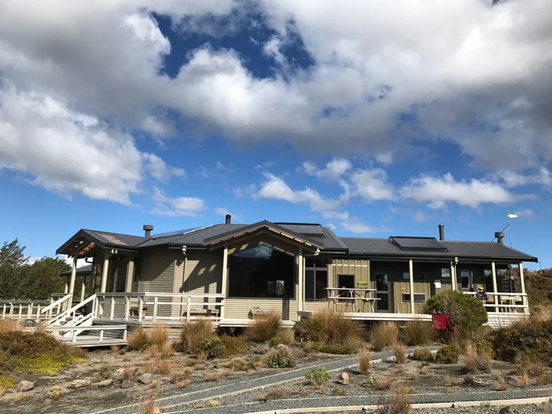
Mangatepopo Hut
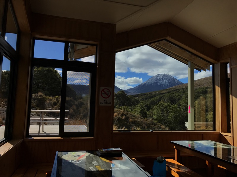
Mount Doom framed in a window at Mangatepopo Hut
Mount Doom
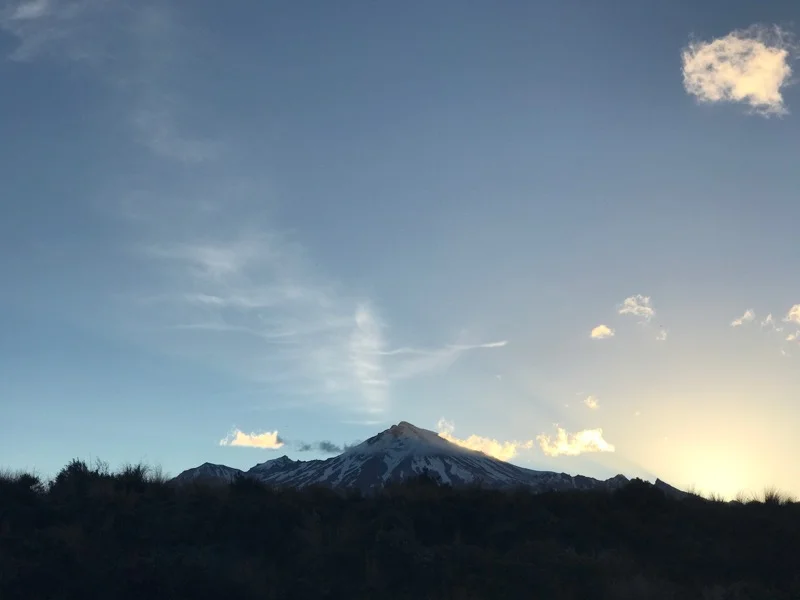
Mount Ruapehu
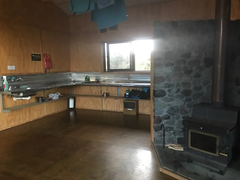
One of the kitchen benches in the hut. There was another on the other side of the stove.
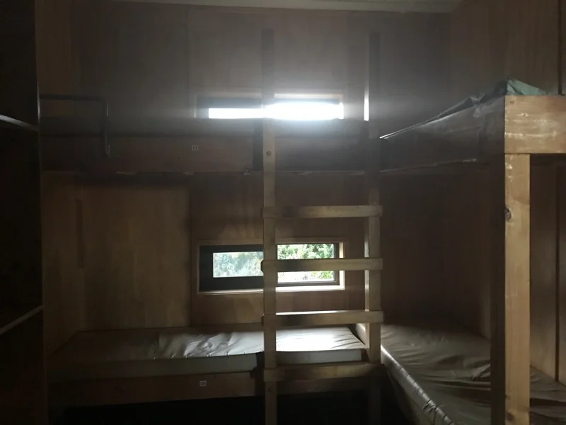
I slept on the top bunk for the night.