Day 49: The Tongariro Crossing (1137-1118)
Tuesday, January 17
Kristen and I woke well before sunrise, a little before 4 am. We gathered our belongings in the darkness and packed our bags in the common area where we could turn on overhead lights. By 4:45 we were ready to board the shuttle with a group of other tourists. It was no competition, we had the largest backpacks by far.
It was only about a 15 minute drive to the parking lot and the start of the trail. For tourists, the normal way to hike the Tongariro Crossing is from the Mangatepopo Car Park north to the Ketetahi Car Park. If you're hiking the Te Araroa Trail southbound (as I am supposed to be), you'd normally walk it from Ketetahi to Mangatepopo. We were happy to reverse it because we heard it was the easier way to tackle the crossing and it would allow us to conveniently meet Tim, who owns hostels in Turangi and picks up guests at Ketetahi in the afternoon.
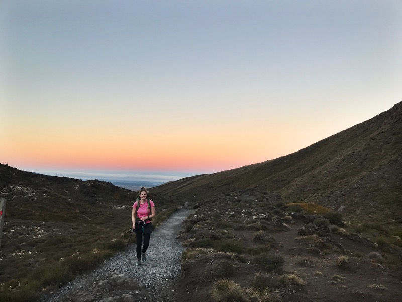
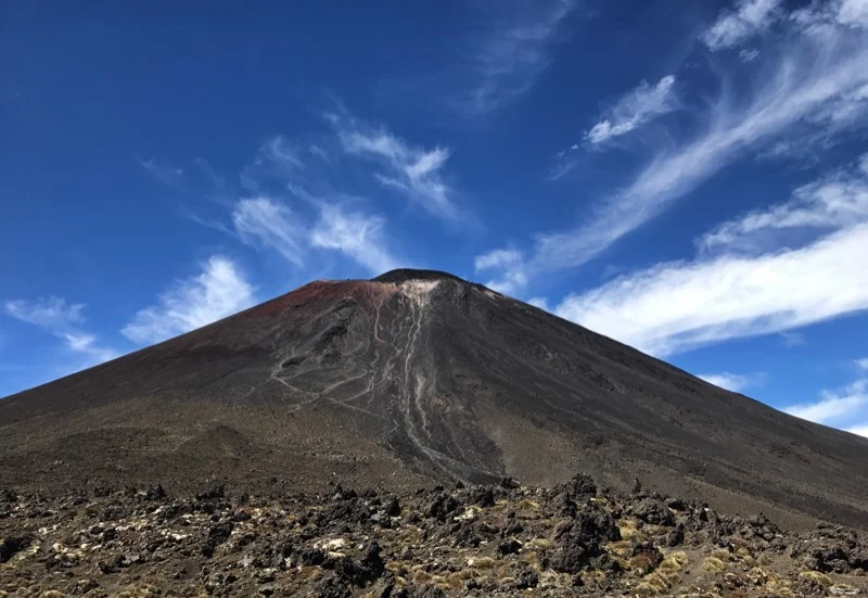
When we arrived at the carpark we were so happy we camped at the campsite because it made us start our hike by 5:30 am. The sky was just starting to turn blue and as we arrived at Mangatepopo Hut, the sky was beginning to turn pink. As we started our climb up to Mangatepopo Saddle, the valley we had left began glowing golden. The sky we were walking towards became brighter and brighter and as we reached the base of Mount Doom (Mount Ngauruhoe) the sun was just beginning to glisten over the mountaintops to the east.
It was beautiful and we were happy we'd be attempting to summit Mount Doom in these cooler, morning temperatures. The woman at reception last night had told us that the mountain took two and a half hours to summit and a half hour to go down. Those ratios seemed crazy to us until we stashed our packs behind some boulders and began to make our way up the volcano. The trail was entirely loose pebbles and boulders for much of the climb up. Until we realized there was some solid rocks we could use to climb up to our left, it was slow going. Even with the nice rock climbing, it was slow going because we were trying to be careful not to dislodge rocks and send them careening down to hikers below us. There were four other people climbing up with Kristen and I, and there was one person on his way down that must have begun his hike early to hit the summit at sunrise.
Watching him come down, we quickly learned why it was a two-and-a-half hour hike up and a half hour hike down. You had to carefully climb up, but to get down you could sort of surf-step on your heels on the small scree.
After about 2 hours we made it to the summit and took lots of photographs. It was more clear of a day than I could have possibly imagined. From the top of Mount Doom you could down the crater, as well as people down below walking the whole crossing. Clouds were starting to veil the valley far off in the distance in the direction we had walked from. The Emerald Lakes, Blue Lake, and Lake Taupo looked like gems gleaming in the dark and barren landscape. And the world seemed to stretch for miles in every direction.
When we decided we had enough pictures and enough of the wind we slid and scree-surfed our way down to the bottom. There was a huge line of people going up the mountain and we were even more glad we had started our hike early. On our way down, we also saw two head-sized boulders get dislodged by hikers and gain speed as they rolled to the base of the volcano. We were so glad we hadn't climbed up with more people and quickly made our way off the mountain and back to the crossing.
The crossing then goes up to Red Crater, the highest point of the crossing but nowhere near as high as Mount Doom. After our three-hour detour the trail was packed with tourists, but it couldn't diminish the beauty of the trail. From Red Crater you could see beautiful views of the Emerald Lakes and Blue Lake.
There was some slide-y scree trail coming down from Red Crater (probably why it's easier to walk the crossing south to north, so you don't need to try to walk up it), but Kristen and I were professional scree sliders after summiting Mount Doom. I only fell on my butt once or twice.
Once we made it past Blue Lake, it was a mostly downhill trail to Ketetahi Hut and then downhill a little over an hour to the Ketetahi Car Park. Hundreds of people, if not close to one thousand people, can walk the crossing in a day. We were lucky to walk it on a lighter day, but when we arrived at Ketetahi Hut there was a line of nearly 20 people waiting for a turn to use one of the two drop toilets.
We would have liked to use the bathroom, but it wasn't worth the wait and we knew there would be some at the carpark in less than two hours.
Maybe halfway from the hut to the carpark there were four drop toilets with no wait at all! It was wonderful. From there we continued the easy walk down to the carpark. We made it there a little after 3 pm and the parking lot was filled with buses and people waiting for their designated shuttles.
Tim arrived around 4 and we talked with him while he waited for some hikers he was picking up to take back to his hostels in Turangi. He was so nice! When we got to town he dropped us off at the supermarket and drove us to the Off The Trail Hostel. It's wonderful! It's smaller so it doesn't get too loud or busy, the wifi is great, the rooms have more outlets than you need, it's only a 10 minute walk from everything in town, and guests get a free bowl of pasta for dinner. Plus Tim has two really nice dogs that never tire of being pet. By 9 Kristen and I could barely keep our eyes open. It had been an early start to the day and we were ready for bed.
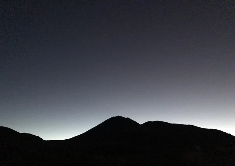
Twilight as we began the trail.
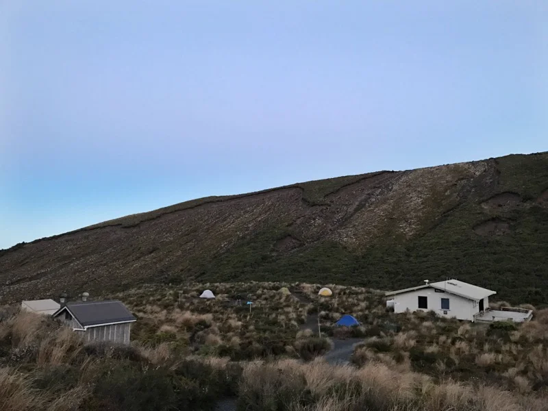
Mangatepopo Hut and campground.
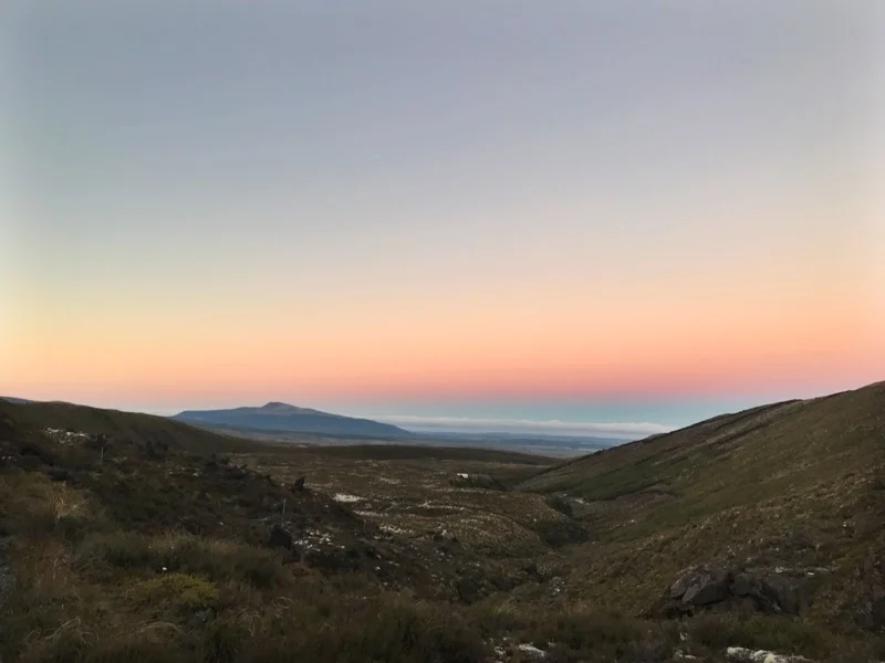
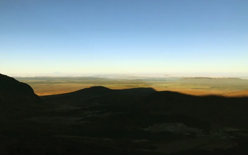
The sun hitting the valley we walked up.
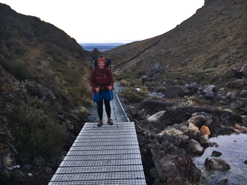
Kristen on the trail
A photo Kristen got of me on the trail.
Golden hour
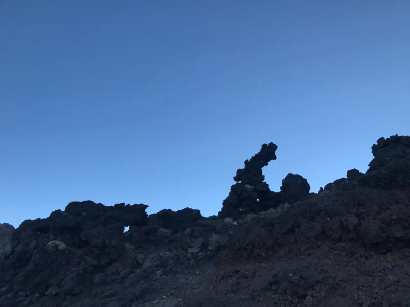
Some interesting rock formations.
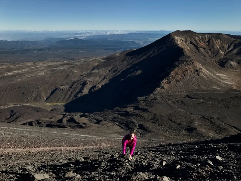
Kristen makes her way up Mount Doom
Kristen's photo of me climbing up Mount Doom
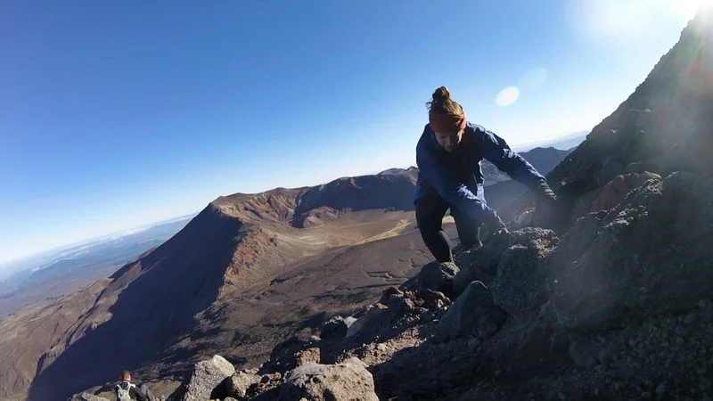
A sweet GoPro shot Kristen got of me clambering up Mount Doom
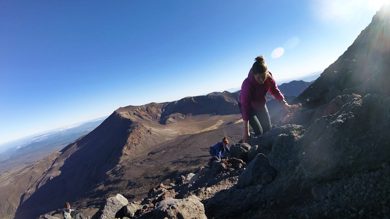
Another neat GoPro shot from Kristen.
Looking over Mount Doom from the summit

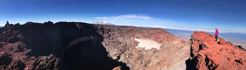
A little more panoramic.
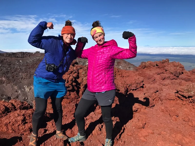
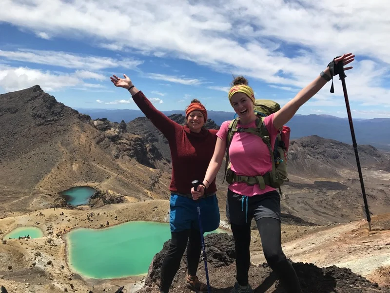
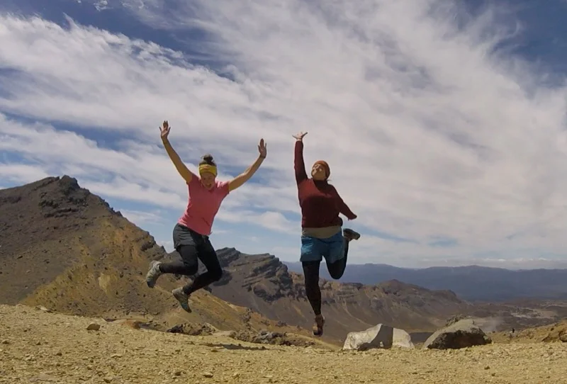
We made it to the top of Mount Doom!

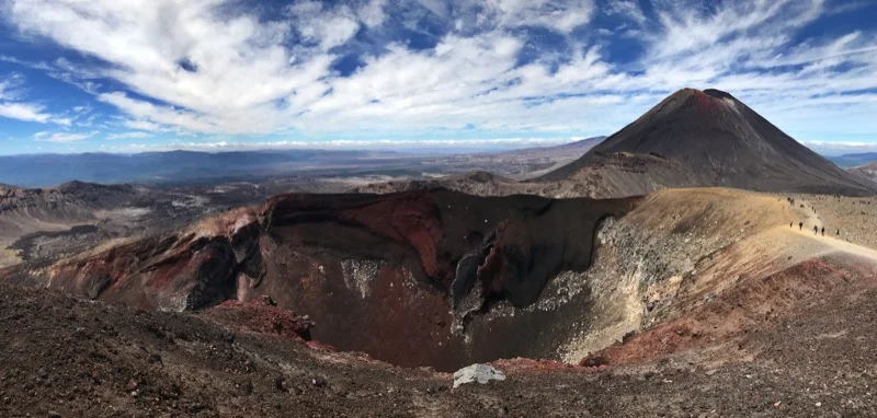
Looking into Mount Doom's crater.
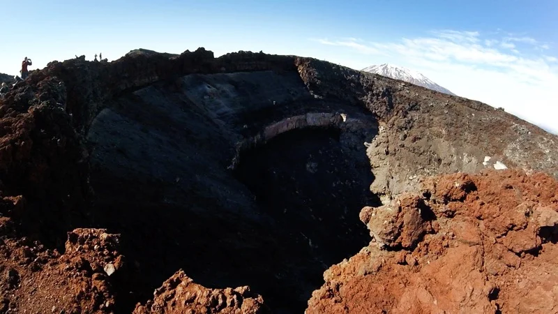
One more photo of the crater. Kristen got this photo of me taking pictures.
Looking out from Mount Doom the line above the yellow ochre blob, through the valley is the Tongariro Crossing trail
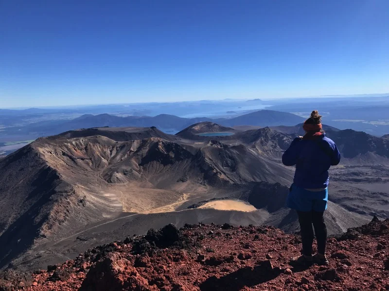
Looking out over the crossing from Mount Doom
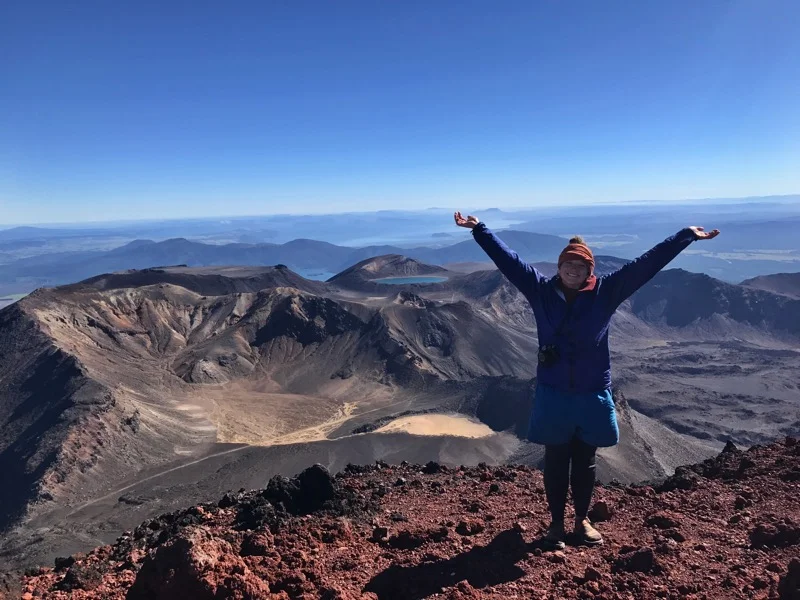
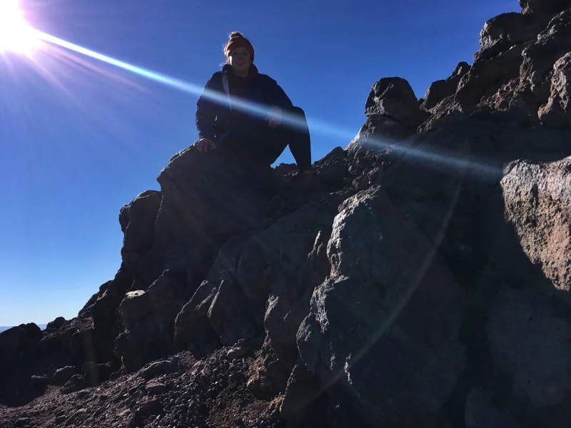
On top of the world (Mount Doom)
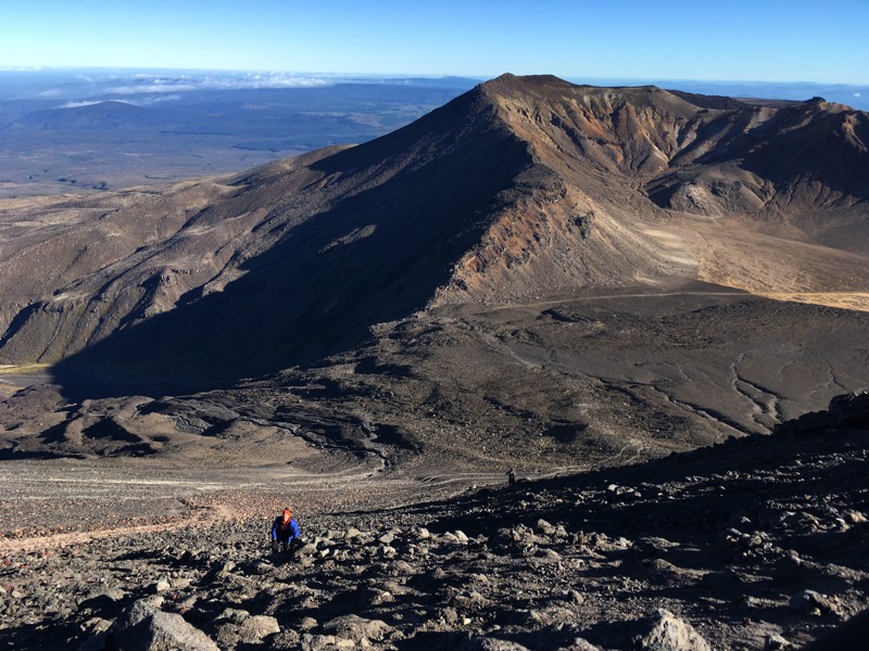
Climbing up or down Mount Doom
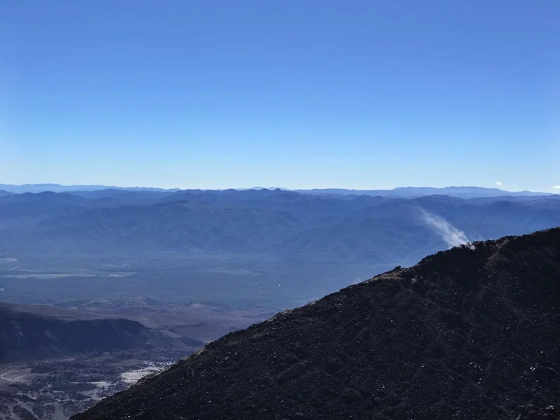
Some steam coming out of the side of Mount Doom
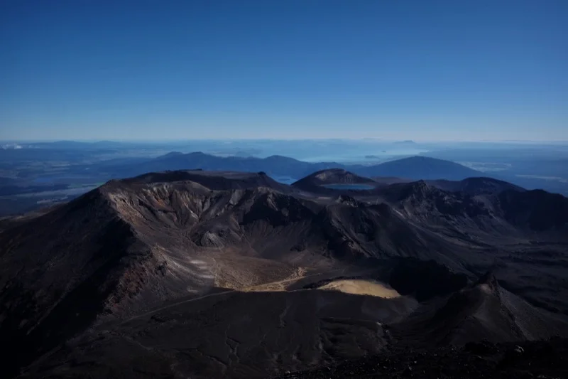
Looking back at the volcano we had just climbed up.
Looking over Emerald Lakes from Red Crater

Red Crater with Mount Doom in the background.
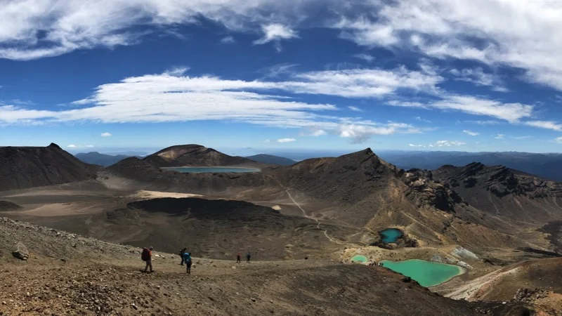
Emerald Lakes on the right and Blue Lake in the center back, as seen from Red Crater
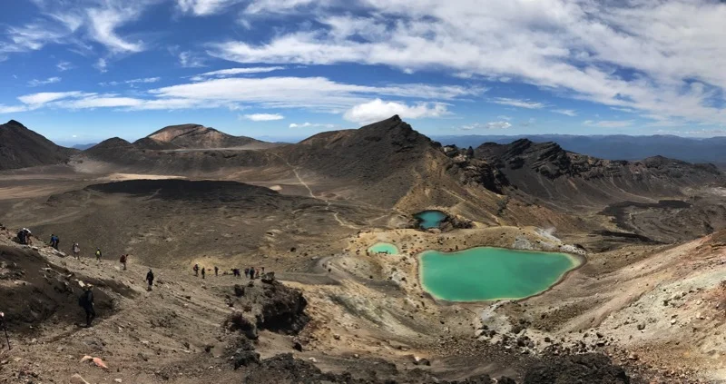
Another view of Emerald Lakes
A fun GoPro shot by Kristen around the Emerald Lakes
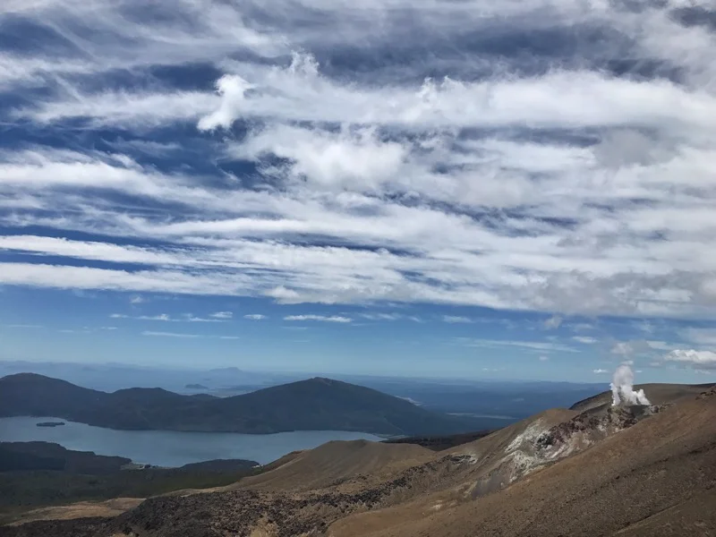
More steam to the right and Lake Taupo (I think)
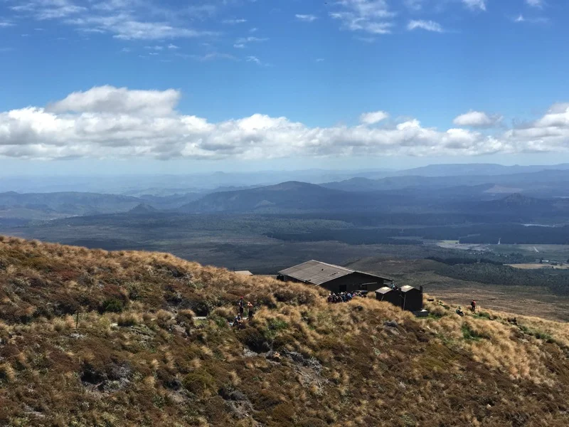
Ketetahi Hit and the long line for the drop toilets.
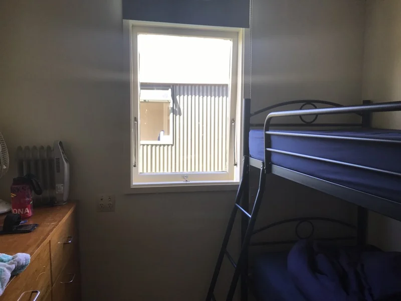
Our nice room at Off The Track Backpackers.